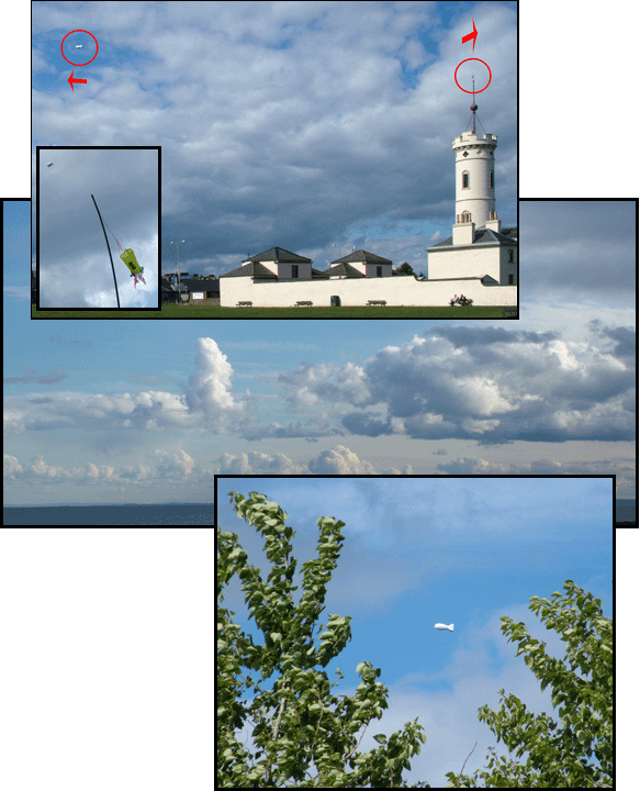
Hi all got a bit of luck a few days ago when it came to getting photographs showing the effect of the coast land/water boundary setting up a sea breeze… all afternoon the MET wind based on the synoptic charts was due to be NW – West in direction and a high chance of being blown out in the hills, however the TAF’s & METAR’s (generate the display on XCWeather, MET Actual Report) were starting to show a sea breeze developing on the East Coast of Scotland (EGPN, EGQL & EGPD) so it was up to the ridge & cliffs at Arbroath, (one of our restricted sites).

The wind vane on the tower is showing a nice SE which the balloon did not match until after 7:30, up till then the upper winds (NW) resulted in me looking at the tail end of the tethered balloon for most of the day!
The leaves folded over on the trees next the Dundee Arbroath road show a 12-15kt SE wind at ground level almost 180* in direction compared to the wind at balloon & cloud level! From the angle of the teather line it looks as if at the balloon height the wind is of a similar strength but NW.
That has to be the most localised (and clearly shown) example of the effect of sea breeze I have ever seen; a 180 degree variation in wind direction over what appears to be less than half a mile! And this with a relatively strong base wind, too.
Comment by FlyingDan — 18/05/2007 @ 12:02 pm